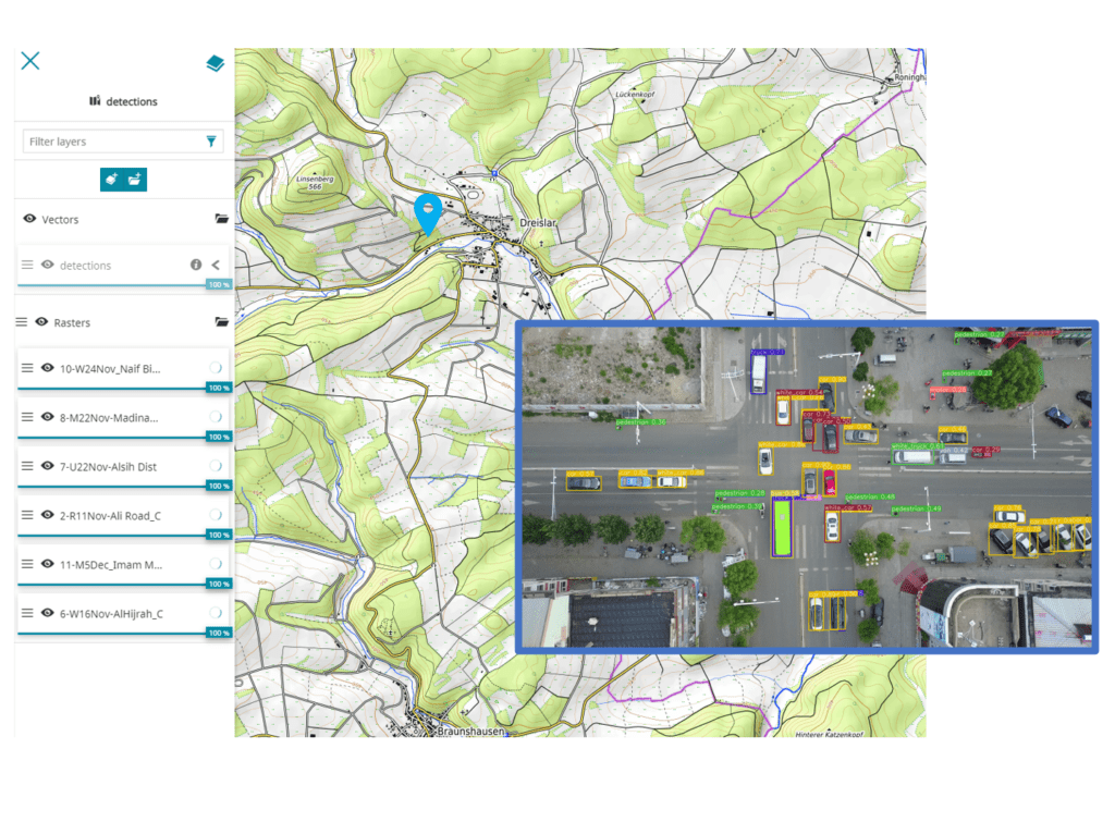
It is an AI platform for automatic analysis of Drone and Satellite images.
Sergey Sukhanov and Ivan Tankoyeu, both founders, managing directors and PhD data scientists at AI Superior GmbH, are very much looking forward to implementing Geospatial Analytics for various customers across different industries and use cases. AI Superior Drone and Satellite image analysis framework extracts insights and streamlines data in a consumable and user-friendly format. The framework is built around an AI engine. It can detect, segment, and track various objects from aerial images. This means that the geospatial data will provide complete automated visual inspection processes.
“More specifically, we create computer vision models that automatically provide image analysis and AI (detects vehicles, trees, trash, buildings, so businesses can detect vehicles, trees, trash, buildings, etc).”, explains Dr. Tankoyeu.
Our customers benefit in different ways from Geospatial Analytics, explains Dr. Sukhanov: “Companies and organizations will save money and time as they will be able to leverage the power of AI for visual data inspection and get rid of manual inspection for example”.
AI Superior is a provider of data science, machine learning and artificial intelligence. The data potential of companies and organizations is tapped through analytics to support people, decisions and processes. AI Superior GmbH is one of the top companies in 2021 in Artificial Intelligence and Machine Learning and member of the German AI Association.