The challenge
Waves had carried tons of litter onto a coastal area, scattering it across a territory of around one thousand square kilometres. Because the objects were spread over many separate islands, finding them by eye was difficult and costly.
The organisation needed an efficient strategy for both detecting and collecting the litter, and drone-based inspection was chosen as the most suitable approach.
Our solution
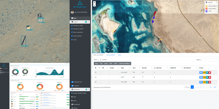
We applied our proprietary computer vision technology for object detection, classification and segmentation to RGB images captured by drone. A partner team operated the flights, covering the whole territory at an altitude of around 50 metres.
We also designed and developed an interactive GIS-based application to display the detections and run collection activities.
- Litter detection, classification and segmentation in drone imagery
- Interactive GIS application showing every detected object on the map
- Optimal route planning for collection teams
- Tracking of collection progress
The outcome
The solution reduced the time needed for litter detection by a factor of 25 and halved the overall detection and collection costs. Collection time fell by a factor of 4.
The automated computer vision solution achieved 7% higher detection accuracy than a human expert, and the system reduced the carbon footprint of the operation by a factor of 19.